Foreign stereographers / publishers -
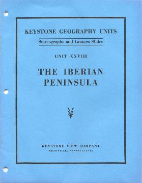
Keystone Geography Units
The Keystone Geography Units are another good example of the company's
concern with the educational use of stereoviews (and the increased sales volume
that their use at school represented). The Educational Department of Keystone
was in fact not only a good marketing idea, it was a very good idea overall.
Actually the use of pedagogical contents supported by stereoviews may be considered
a precursor of multimedia. It was innovative, very well received and helped to
keep the company running far longer than their competitors (recall that Keystone
ceased regular production in 1939, and that the factory closed doors only on 1976). The accompanying booklets contained
instructions for teachers and students, including questions and other
complementary materials.
Having said this, I do not resist to express my surprise in relation to the very
uncommon
definition of Europe that is presented in the Iberian Peninsula booklet
illustrated on the right: "In reality Europe is a peninsula of Asia, our largest
continent, and is made up of a number of smaller peninsulas." Thinking twice,
that may help to explain why so many US citizens know so little of European
geography...
Before getting on to the views, it may be interesting to exemplify the type of
contents provided to accompany each view. The section dealing with stereoview
#695 in the Iberian Peninsula booklet (A Peasant's Home in Northern Portugal
� possibly the same image as
view #491 in the 1,200-card World set?),
dated 1938, discusses this
view as follows:
Does this peasant's home suggest that northern
Portugal is a very prosperous region? Give a reason for your answer. By what
means do they earn a living? Most of the peasants in the north own their own
land, but they do not raise enough for their own needs. Is there anything to
indicate why they do not produce more? What do you think is growing in the
garden? What is planted along the fence? The child is standing in a field of
oats.
With what are the hills in the background covered? Because of the heavy
rainfall, forests cover much of the mountains in the north. Oak, chestnut, and
pine are found in these forests. The oak and pine furnish some lumber of poor
quality. The chestnut is of value chiefly for the nuts.
This type of home and village is to be found throughout the uplands in the
north. The villages consist of farmers and their families, who raise the crops
mentioned, some poultry, and a few cattle. The people are very poor, and in many
sections there is not even a wagon road to the villages.
What is the largest river valley in the north?
What more can I tell you? A very dull description indeed. Take some time to read W. H. Koebel's Portugal: It's Land and People (1909), and you'll learn a bit better. The type of card mount is illustrated below for a view of Mozambique that belongs to Keystone Geography Unit 42:
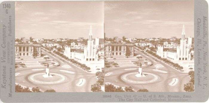 |
|
| Grey curved card mount with round-corner images. Printed vertically on the left: "Keystone View Company - Manufacturers, [copyright information], Made in U.S.A., Publishers". Printed vertically on the right: "Meadville, Pa., New York, N. Y., - Chicago, Ill., London, England." The card number is written on the upper left. The negative reference number and the caption are printed horizontally on the lower right. |
(see the views)
ANTIQUE STEREOVIEWS OF PORTUGAL
Copyright � 2003 J. M. Martins Ferreira. All Rights Reserved.
N.B.: An updated version of this website is available since 2019 at http://ptstereo.wordpress.com.